

Mother of God, on land belonging to the mythical ancient times Antisuyo Inca, is an exotic region, mostly unexplored, extending southeast of the country.
It is the land of the dreamy realms of El Dorado and Paititi, eagerly sought by bold explorers of all time.
Their territories, forgotten and marginalized for centuries are virtually cut off by the difficulty of reaching them.
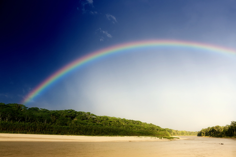
The only permanent access is by air, navigable rivers of the region are only partly useful due to the rapids, the roads are terrible and during the rainy months, trails become muddy. For people in the department, the rivers are their roads, their paths and trails. They are the communication channels necessary to join population centers and carryon trade.
The Madre de Dios basin, approximately 95 000 km2, originates in the snowy Pucara, in the province of Cuzco Paucartambo.
The river system of the Mother of God-with a total of 17 rivers, 20 lakes and 61 streams-is divided into two main sections, and is of vital importance for colonization and forest exploitation: the top is close to Cuzco and Puno, and bottom approaches the jungles of Brazil and Bolivia.
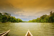
The easiest and safest way to get to Puerto Maldonado is the airway, using the river is, at present, reserved only for the very bold.
MANU NATIONAL PARK
Established as a National Park since May 29, 1973, it is located in the province of the same name in the department of Madre de Dios. Its total area covers 1,881,200 ha.
A Reserved Zone surrounding it was legally established on 26 June 1980, a relatively small part of it reaches to the province of Paucartambo, the departament of Cuzco.
Manu National Park, recognized by UNESCO as a Biosphere Reserve in 1977, and as a World Heritage Site in 1987, is divided into three main areas:
- Central Area or the National Park itself, exceptional access of an intangibleterritory of 1,532,806 inhabitants.
- Buffer zone or Restricted Zone, which extends from Boca Manu to Broken Panagua, research is not allowed and there is controlled sightseeing. It covers 257 000 hab.
- Multiple Use Zone, which allows all kinds of human settlements and activities which are expected to be conducted with the environment in mind. It covers 91,394 ha, from the sentry post near Ajcanaco to the native community of Diamante, in the Upper Madre de Dios.
 ECOLOGY AND WILDLIFE
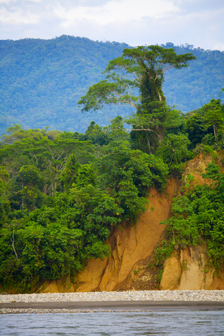
Manu National Park is located in the Puna bio-regions and high in the Andes, high and lowland rainforest, the latter covers the largest area of the park.
Because of its multiple altitudes it has a surprising variety of ecosystems, of great interest not only to tourism but also to science.
Based on the classification proposed by biologist Leslie Holdridge to determine bioclimatic units, originally "plant communities" - this park is designated for the following areas of life:
a) Tropical moist forest-
It covers the north and northwest of the park, in an area that rises between 200 and 700 m, with an average temperature of 24 0C.
One of the most important aspects of this area is the extreme biodiversity of flora, its forests are tall and remain green all year round and dense, continually producing flowers and fruits.
The woody stems are wrapped with moss, vines, orchids, and parasites, and are estimated at least 100 tree species present.
b) Sub-tropical moist forest
This is located in the lower eastern slopes of the Andes that reach the park, as well as in certain low mountain ranges and is not very extensive.
Areas of high forest heights range from 50 to 2000 m, whereas in the lowland lies between 150 and 250 meters.
This area is mainly populated with evergreen trees, but there are some species of deciduous which lose their leaves during the dry season. They are also abundant varieties of palms.
c) Mountain wet forest
This region is also known as “jungle", and covers the sectors located in the foothills of the Andes, at elevations ranging from 2500 to 3800 m.
It is characterized by relatively low temperatures, with a high incidence of fog and low cloud cover due to excessive moisture, and therefore also known as "cloud forest."
The vegetation in this area is usually dense forest, in which both the trees and shrubs are covered by epiphytes (like orchids), ferns, mosses and lichens, but are also characteristic of species found in the highlands or plateau.
Generally, with increasing altitude, the plant size will shrink.
d) Area Altoandina
This area, also called sub-alpine rain, is within the park in the western Andean area, starting in the southwest boundary section from Ajcanaco to Tres Cruces.
It is grasslands dominated by grasses, except in stony places or at higher altitude where the vegetation is woody. In this area there are dwarf varieties of trees.
MACAW LICK
If you follow the river from Cocha Cashu towards Tayakome (five or six hours), no new species appear, but soon you will come to a ravine where there is a formation rich in minerals or where numerous wild animals congregate to supplement their diet.
Due to the large, colorful and vociferous presence of macaws, this “colpa" been called "Manu Macaw Lick."
 ETHNICITIES MANU NATIONAL PARK
Within the limits of the park, there are some native aboriginal groups. The best known are the Machiguenga of Tayakome, the only group in the region in touch with today's culture.
The other groups are the Amahuacas and Yaminahuas, belonging to an ethnic and linguistic group completely different from the Machiguenga.
These groups are very primitive and there is no contact with them. They have been observed during the rainy season moving to the headwaters of the rivers, where they probably keep crops, and during the dry season going to the Manu River to collect eggs.
We also know that there are un-contacted Yaminahuas in some areas frequented by Amahuacas, north and northeast of the park. These tribes are hostile to each other, and both are also enemies of the Machiguenga.